Editor’s Note: This article was originally published in Bird Observer (Vol. 52, No. 4). A special thank you to the Bird Observer for permission to reprint it here, with updates.
In Part One, we explored Concord’s southern floodplains and central river corridor. Now we move north of Exit 16 (I-93), where extensive farmland, silver maple floodplain forest, marshes, and river rapids create some of the city’s most diverse birding opportunities.
This section includes West Locke Road and the East Concord Heritage Trail system, the floodplain forest, Turtle Pond, Sewall’s Falls, and Morono Park. All of these sites are within a few miles of one another and all offering something different depending on season and water levels.
Map 2. Concord, New Hampshire, Points of Interest (POI) 6-12.
Access this collection of exceptional birding spots from Exit 16. See Map 2. To the west of the interstate is an extensive area of farmland, marsh, and forest encircled by pedestrian-only West Locke Road, Locke Road, West Portsmouth Street, and the Merrimack River. The city calls this site the East Concord Heritage Trail; the eBird hotspot name is West Locke Road (Map 2, POI 6). You can download a trail map here.
This collection of sites is one of the best birding places in Concord. Although Horseshoe Pond is significantly better for waterbirds, the more diverse habitats along West Locke Road, in particular, support more landbirds and at all times of year.
West Locke Road
Take Exit 16 and turn left onto West Portsmouth Street. In 0.2 miles, turn right onto Locke Road and drive 0.5 miles to the gated trailhead for West Locke Road (43.2430, -71.5443). Park at the gate and walk down West Locke’s gravel road to an extensive marsh on the right. This wetland is a reliable area for Virginia Rails, Green Herons, and sometimes American Bitterns.
A little farther along is the Canal Trail (43.2417, -71.5481) on the left. It is a 0.3 mile spur trail that follows an old tow path between woods and an open wetland, which is heavily influenced by beavers. The mix of forest and water along this trail provides a good diversity of species well into summer. In winter, listen for Winter Wrens where there is open water. One winter there were four in this general area.
Backtrack from the Canal Trail to West Locke Road and turn left. Soon you will come to a shrubby wetland on the right. This is a good spot for Green Herons and is where you are most likely to see waterfowl if the water is high enough. After the wetland, the road passes through a strip of forest that hosts breeding Blue-gray Gnatcatchers and can be excellent for migrants in May.
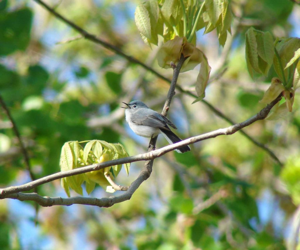
Blue-gray Gnatcatcher by Pam Hunt, 5-12-2011, Concord, NH.
Beyond this is a large field on the right; please stay off this active farmland. Savannah Sparrows are the only grassland species to nest here most years, but Vespers may breed occasionally. It can be better in fall for migrant sparrows, pipits, and larks, depending on what crops were grown the previous summer.
Continue walking until the gravel road curves toward the right. At this point, there are three options. If you have limited time to explore, this is a good place to head back to your car.
The second option is to turn right and follow the road through the field to a small grove of trees next to a remote-controlled aircraft field. This provides more central access to whatever birds are deeper in the field, which may prove most worthwhile in autumn. Sometimes American Kestrels frequent the grove of trees. Just after the road bends is a short side trail on the left (43.2410, -71.5557). It drops into the floodplain. Along with the brushy edge leading up to it, this is another good area for migrants and floodplain breeders like American Redstarts and Blue-gray Gnatcatchers. If it is not flooded, make a short detour to the river for glimpses of Spotted Sandpipers or Bald Eagles before exploring the field.
A third option is to take the Riverwalk. This is the first left at the bend (43.2402, -71.5545) which follows the river south and eventually connects with West Portsmouth Street. It is worth going a short distance down this trail to scan the river for waterfowl. Waterfowl is most often seen in winter and migration; in summer, there are Bank Swallows. Unless you walk all the way to West Portsmouth Street, you do not need to continue south beyond your first vantage point along the river. Otherwise, turn around at the river and retrace your steps to the West Locke Road trail back to your car.
West Portsmouth Street
Drive south on Locke Road and continue south onto West Portsmouth Street as it curves around the extensive cornfield (Map 2, POI 7). The cornfield is the main draw here. The field is best in spring when flooded portions are used by waterfowl in March and April, and occasionally by shorebirds in April and May. Remnant grain may attract a Sandhill Crane or two. Although parts of these fields can be seen from the road, the topography hides several swales that are not visible unless you walk out. Park where the road bends (43.2308, -71.5381) and walk northwest, bearing right at the line of trees. You will approach a wet swale you cannot see from the road. This can be an excellent area for dabbling ducks and snipe, although it is difficult to approach without flushing them. In fall and winter, these fields host pipits, larks, and other flocking birds of open country.
SPNHF Floodplain Forest
On the east side of I-93 at Exit 16 is a large area of floodplain forest preserved by the Society for the Protection of NH Forests (SPNHF). At the traffic circle take your first right onto Route 132/East Side Drive. In 250 feet, turn right onto Eastman Street. On your left after you pass a small market is Merrill Park (43.2347, -71.5349) (Map 2, POI 8). This small city-owned park will be busy on warm summer days, but during migration it is usually empty. Birders have regularly turned up unexpected things, among them a Blackburnian Warbler one November. It does not take long to check the edges of the stream and fishing pond. Two trails connect Merrill Park to the SPNHF floodplain trailhead to the southeast if you want to walk. Otherwise, drive past Merrill Park on Eastman Street, make a hairpin left turn onto Portsmouth Street, in 0.3 miles you will reach the SPNHF trailhead on your right (43.2338, -71.5310) (Map 2, POI 8). You can download a SPNHF trail map here.
The SPNHF floodplain is popular with dogwalkers and is best visited early in the morning. With several trails between the Merrimack River and a steep bluff, it is the most accessible area of silver maple floodplain forest in the city. Birds typical of this habitat include Veerys, Warbling Vireos, and Baltimore Orioles. Until recently, there was a large Bank Swallow colony here. Though it is currently inactive, you will see signs and roped-off areas. Sometimes you may see swallows, presumably from a yet-undiscovered alternate site up or downstream. You can spend one to two hours here on roughly 2.5 miles of trails.
Turtle Pond
Farther northeast off Exit 16 is Turtle Pond, also called Turtletown Pond (Map 2, POI 10). From the traffic circle on Route 132, turn right onto Shawmut Street. In 0.75 miles, bear left at the slight V-intersection onto Oak Hill Road. Continue for 0.75 miles to the pond (43.2550, -71.5217).
Unless you are looking for waterfowl in early spring, it is best to get here early before boaters descend on the pond. Turtle Pond is one of the best waterfowl spots in the city, and probably the best for diving ducks such as scoters and Ruddy Ducks, mainly in October and November. It is also reliable for Pied-billed Grebes during migration. The marsh next to the parking lot usually has Virginia Rails and may be the most reliable location in Concord for Marsh Wrens, although they do not seem to stay to breed. A scope is extremely helpful here because the ducks often frequent the far edges of the pond, as do the shorebirds if the water is low.
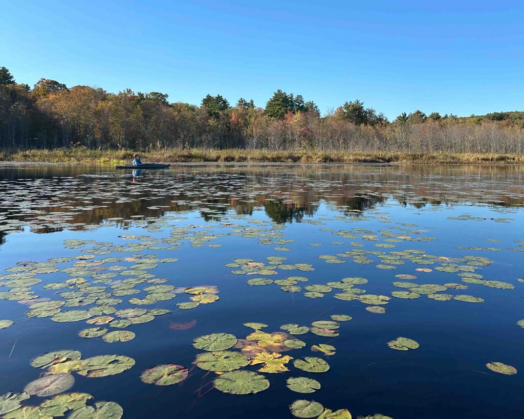
Turtle Pond in fall by Grace McCulloch.
Sewall’s Falls
Sewall’s Falls (Map 2, POI 11) is a section of Concord’s floodplain that lies between Exits 16 and 17. See a trail map here. It can be reached by taking Mountain Road (Route 132) north from Exit 16, or North State Street (Route 3) north from Horseshoe Pond. Either route leads to Sewall’s Falls Road, which connects them.
Sewall’s Falls is a rapid section of the Merrimack River and the site of an old dam. A trail follows the river on the west side. You can park at either end of the trail. There is a parking lot along Sewall’s Falls Road at the north end next to a bridge (43.2698, -71.5648), and another off Second Street at the south end near the old dam (43.256743, -71.557389). The main draw of the riverside trail is a chance to check the Merrimack for Barrow’s Goldeneyes between December and March, when one or two are usually with the large flock of Common Goldeneyes that frequent the area. If you do not see any goldeneyes from the trail, check the river below the dam. From the end of Second Street turn right, park, and walk south to a spot where you can view the water. Sometimes the goldeneyes are well to the south. A scope is useful, but if you are patient they may wander upstream.
Morono Park
From Second Street, you can also access Morono Park (Map 2, POI 12), another unappreciated birding gem in the city’s park system. See a trail map here. Park in the small lot just before the railroad tracks (43.2565, -71.5601) and walk the old road into the park. This road passes between a wooded hillside and an oxbow pond, providing the potential for a good mix of species. Partway down the road is a small stream that usually has nesting Louisiana Waterthrushes. Just beyond it is an open area lined with shrubs that can be good for migrants and sparrows.
The southern end of the pond, about a mile from the trailhead, is the best area for waterfowl and other wetland birds. It is partially spring-fed and often remains open in winter, when it may hold surprises such as American Wigeons or Great Blue Herons. Follow the trail that veers right at the end of the pond, do not continue straight because the fields ahead are the property of the New Hampshire State Prison. The trail eventually splits to return uphill near residential areas along North State Street. The woods in this section sometimes have a Wood Thrush or two, and the thickets at the trail intersection are always worth checking.
Reflecting on all Concord Has to Offer
From winter goldeneyes at Sewall’s Falls to marsh birds along West Locke Road and diving ducks at Turtle Pond, northern Concord adds depth to an already remarkable urban birding landscape.
All told, these sites span only a handful of river miles. A birder could spend a full day sampling them or return again and again as seasons shift and water levels change. However you approach it, Concord’s stretch of the Merrimack River offers reliable variety, surprising rarities, and the kind of accessible habitat network that keeps local birders coming back. If you didn’t get a chance to read Part One of this article, check it out here.
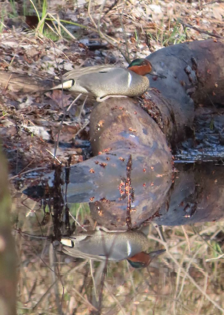
Green-winged Teal by Pam Hunt, 4-15-2022, Concord, NH.